El Niño 2026: How One Climate Pattern Can Affect Food, Rain and Daily Life
El Niño 2026 is strengthening in the Pacific. Learn how it can shift rain, drought, harvests, fisheries and food prices without affecting every region alike.
By Wajeeha Iqbal
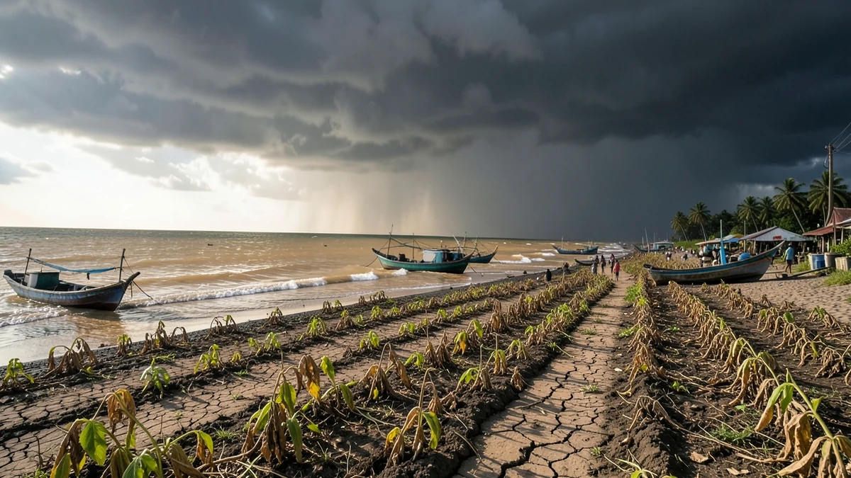
El Niño 2026 is no longer merely a possibility. In its 9 July diagnostic discussion, the U.S. National Oceanic and Atmospheric Administration said El Niño was continuing and strengthening, with the coupled ocean and atmosphere displaying a clear event. NOAA estimated a 97 percent chance that it would persist through early spring 2027 and warned that it could become very strong later in 2026. The next monthly assessment was scheduled for 13 August, so this article reflects information available on 10 August.
That forecast matters, but it is not a prediction that every country will become hotter, drier or wetter in the same way. El Niño shifts probabilities in a complicated climate system. Local weather still depends on season, geography, ocean conditions outside the tropical Pacific and ordinary atmospheric variability. The pattern can influence food and daily life across the world precisely because its effects are broad—but never uniform.
What El Niño actually is
El Niño is the warm phase of a recurring climate pattern called the El Niño–Southern Oscillation, or ENSO. Its center lies in the tropical Pacific Ocean, where the ocean and atmosphere continually exchange heat, moisture and momentum.
In neutral conditions, easterly trade winds generally push warm surface water toward the western Pacific. Cooler water rises nearer the South American coast through a process called upwelling. The warm western ocean helps air rise and supports heavy tropical rainfall, while the colder east has different atmospheric conditions.
During El Niño, the trade winds weaken or sometimes reverse in episodes. Warm surface water spreads eastward. The depth of the thermocline—the boundary between warm upper water and colder deep water—changes across the basin. Upwelling in the eastern Pacific can be reduced, and the main zone of tropical clouds and rainfall shifts.
The atmosphere responds to the ocean, then feeds back into it. That coupling is essential. A warm patch of water by itself is not enough to describe a full El Niño; forecasters look for sustained ocean temperatures and a consistent atmospheric response, including winds, pressure and rainfall.
What the 2026 advisory says
NOAA’s July 2026 update reported sea-surface temperature anomalies above 1°C across a large part of the central and eastern equatorial Pacific, with the weekly Niño-3.4 index at +1.2°C. Westerly wind anomalies and changes in tropical convection indicated that the ocean and atmosphere were acting together as an El Niño system.
Forecast confidence was unusually high for persistence into 2027. NOAA also estimated an 81 percent chance of a “very strong” event during October–December 2026. That is a probabilistic forecast, not a guarantee. It describes the likelihood of an ocean index crossing a defined threshold; it does not promise that every textbook El Niño impact will occur.
The World Meteorological Organization had already urged preparation in June. It stressed that no two events are alike and that other climate drivers remain important. That qualification should travel with every headline about El Niño 2026.
How a Pacific pattern reaches distant weather
Tropical rainfall releases large amounts of heat into the atmosphere. When the location of that rainfall changes, it can alter large-scale circulation and wave patterns in the upper atmosphere. Those changes influence storm tracks and the odds of seasonal temperature or precipitation anomalies thousands of kilometers away.
These relationships are called teleconnections. Some are relatively consistent in particular seasons; others are weak or change from one event to another. A strong event tends to push probabilities more clearly, but strength alone does not determine local outcomes. The precise location of warm water, the timing of the event and conditions in the Indian, Atlantic and other parts of the Pacific all matter.
This is why a global map labeled “El Niño effects” must be read as a tendency, not a daily forecast. Farmers and emergency planners need national and regional outlooks that translate the broad pattern into local probabilities.
Rainfall: drought in one place, flood in another
El Niño is often associated with drier conditions in parts of Southeast Asia and the western Pacific, while parts of the eastern Pacific and other regions can receive more rain. Seasonal effects may extend to southern Africa, South America, North America and beyond, but the direction and strength depend heavily on time of year.
Reduced rain over several months can lower reservoirs, dry soils and delay planting. When heat accompanies drought, crops lose water faster and livestock face both thirst and reduced forage. Forest and peat fires may become easier to ignite and harder to control.
Elsewhere, intense rainfall can produce river flooding, landslides and crop disease. Rain after drought may run rapidly from hardened soil instead of replenishing it. Coastal communities can face storm and erosion risks. A country may even contain both drought and flood conditions in different regions.
The important point is not that El Niño “causes drought and floods” in a contradictory way. It changes atmospheric circulation, and different locations sit on different sides of that rearrangement.
Agriculture depends on timing, not just totals
A seasonal rainfall total can look near normal while a harvest fails because the rain arrived at the wrong time. Seeds need moisture to germinate. Flowering and grain filling have their own temperature and water requirements. Heavy rain at harvest can damage a crop that benefited from earlier moisture.
El Niño can affect planting calendars, irrigation demand, pasture and the pressure from pests or plant diseases. Tropical crops such as rice, maize, cocoa, coffee, palm oil and sugar may face region-specific risks, but it would be misleading to forecast all of them in one direction. Some growing areas may benefit from extra rain or fewer storms; others may lose yield.
Farmers respond using seasonal forecasts, different varieties, adjusted planting dates, water storage and crop diversification. Their capacity to act varies. A large producer may hedge prices or irrigate; a smallholder may depend on one rainy season and have little access to credit. The same climate anomaly therefore produces unequal economic outcomes.
From fields to food prices
El Niño can affect food prices when weather reduces production, disrupts transport or leads governments and traders to expect scarcity. But the route from ocean temperature to a supermarket bill is not automatic.
Global stocks, energy and fertilizer costs, exchange rates, trade policy, conflict and shipping all influence prices. If drought damages one producing country while another has a strong harvest, world supply may absorb the shock. If several important regions suffer at once, the effect can be larger. Export restrictions introduced to protect domestic consumers may intensify international prices.
Expectations matter too. Futures markets and buyers react before final harvest numbers are known. Some price movements reflect reasonable risk; others may overshoot. Consumers in lower-income households are generally more exposed because food occupies a larger share of their budget. A modest percentage increase can force a choice between diet quality, medicine, rent and school costs.
It is therefore responsible to say that El Niño 2026 raises food-system risks, not that it guarantees a universal food-price surge.
Fisheries and the altered ocean
Along parts of the west coast of South America, reduced upwelling during El Niño can limit the cold, nutrient-rich water that supports plankton and productive fisheries. Fish distributions may shift, affecting catches and the seabirds or marine mammals that depend on them.
The outcome varies by species and event. Some warm-water species expand into new areas, creating temporary opportunities. Others decline or move beyond the reach of familiar fleets. Aquaculture can face heat, low oxygen, disease or harmful algal blooms.
Fishing communities need forecasts that connect ocean conditions to local species rather than treating “the fishery” as one system. A change in catch also moves through processing plants, feed markets and household nutrition.
Heat, health and the environment
El Niño adds temporary heat to a climate already warmed by greenhouse-gas emissions. It does not create long-term global warming, but the two influences can combine. WMO noted in June that a warmer ocean adds heat and moisture to the system and can intensify some extremes.
Heat increases risks for outdoor workers, older people, young children and those without reliable cooling. Drought can concentrate pollutants or reduce clean water. Floods can damage sanitation. Changes in rain and temperature affect the habitats of mosquitoes and other disease vectors, although disease outcomes also depend on public health, immunity and local ecology.
Environmental effects can cascade as described in our guide to extreme weather, forests and wildlife. Dry vegetation increases fire risk; fire smoke affects distant cities; heavy rain over burned land produces debris flows. The sequence can matter more than any single monthly anomaly.
Why regions experience different El Niño events
Climate change further complicates historical comparisons. Past El Niño years remain useful, but they occurred on a cooler baseline and with different land use, populations and infrastructure. A strong event in 2026 should not be assumed to reproduce 1982–83, 1997–98 or 2015–16 exactly.
What households may notice
For most people, El Niño will not appear as a visible object. It may arrive through a warmer night, a water restriction, smoky air, an expensive staple, an altered fishing season or news of flooding elsewhere. Supply chains can transmit distant weather into local prices even when local rainfall is normal.
Household preparation should follow local agencies, not generic viral maps. Useful actions may include heat planning, water conservation, checking flood routes, protecting important documents and understanding food or medicine needs during transport interruptions. Panic buying can worsen shortages and waste.
Businesses and public agencies have wider responsibilities: protect workers from heat, maintain drainage, pre-position emergency supplies, monitor crops and disease, communicate forecast uncertainty and support farmers before losses become irreversible.
Forecasts are tools, not verdicts
Seasonal forecasting cannot tell a particular farmer whether it will rain on a specific Tuesday months ahead. It estimates whether a season is more likely to fall into broad categories. That information has value when combined with short-range forecasts and local observation.
Probabilities should be updated. NOAA’s July diagnostic was the latest monthly assessment available on 10 August, with another due three days later. Anyone making operational decisions should use the new bulletin and their national meteorological service.
The central lesson of El Niño 2026 is not that one ocean pattern controls the planet. It is that distant systems are connected. Warm water in the Pacific can tilt rainfall, harvest and fisheries, but institutions determine how well societies anticipate those shifts and protect people with the least room for loss.
El Niño changes the odds. Preparedness changes what those odds mean.
Sources & Further Reading
- ENSO Diagnostic Discussion, 9 July 2026, NOAA Climate Prediction Center
- WMO El Niño/La Niña Bulletin, June–August 2026, World Meteorological Organization
- El Niño theme page, National Oceanic and Atmospheric Administration
- El Niño and agriculture, Food and Agriculture Organization of the United Nations


