
Why Mountaineering in Pakistan Is Becoming More Dangerous in 2026
Mountaineering in Pakistan in 2026 demands route-specific judgment as snowfall, avalanches, unstable ice, altitude and limited rescue overlap today.
By Wajeeha Iqbal
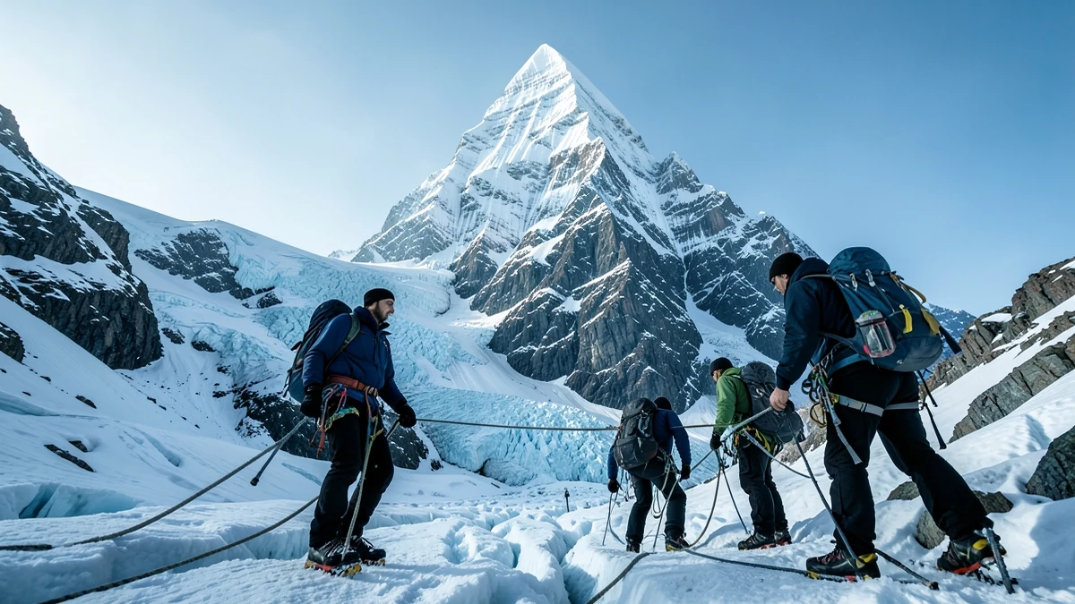
Mountaineering in Pakistan in 2026 cannot be reduced to the claim that the mountains are either “open” or “unsafe.” Pakistan contains hundreds of distinct objectives across the Karakoram, western Himalaya and Hindu Kush, from trekking peaks to remote technical walls and five mountains above 8,000 metres. Risk changes with the mountain, route, altitude, recent weather, snowpack, team, equipment and decisions made on a particular day.
That distinction is especially important on 10 August 2026. The deaths of ten climbers in an avalanche on Broad Peak at the end of July have brought new attention to the hazards of the summer season. The disaster is not proof that every route in northern Pakistan has identical conditions. It is a grave reminder that being inside the traditional expedition calendar does not make a slope stable—and that consequences become harder to manage as altitude and remoteness increase.
This article is informational. It cannot replace an expedition-specific forecast, snow assessment, permit information, local authorities or professional high-altitude guides.
A landscape larger than one famous mountain
International discussion often uses K2 as shorthand for Pakistani mountaineering. K2 deserves its formidable reputation, but it is one part of an immense high-mountain system. The Karakoram contains Broad Peak, the Gasherbrums, the Trango Towers, Masherbrum and many less-publicized summits. Nanga Parbat stands in the western Himalaya, while the Hindu Kush extends through the northwest.
These ranges do not share a single weather switch. A storm can load one basin while another receives less precipitation. A shaded couloir may preserve winter snow while a sun-exposed rock face enters a dangerous freeze–thaw cycle. Conditions at base camp say little about a slope two vertical kilometres higher. Even neighboring K2 and Broad Peak have different route geometries, avalanche paths and objective hazards.
Pakistan’s great-altitude expeditions also take place within living landscapes. Balti, Hunza, Shimshali and other mountain communities possess generations of environmental knowledge. Local climbers, porters, cooks, drivers and rescue personnel make expeditions possible. Treating them merely as logistics ignores the people most familiar with approach routes, seasonal signals and the consequences when visitors need help.
Why July and August are climbing season—but not “safe season”
The central Karakoram’s major expedition season normally falls in summer. Compared with winter, temperatures are less extreme, days are longer, access routes are more practical and periods of comparatively settled weather may occur. Expeditions need those advantages for acclimatization, carrying loads, fixing ropes and attempting summits.
But “best time” means a period in which success may be more feasible, not a period without danger. Summer brings its own instability. Moisture can reach the Karakoram through variable interactions involving the South Asian monsoon and westerly weather systems. High elevations can receive snow even when valleys receive rain. A sequence of snowfall, wind and rapid warming can produce very different problems within days.
Climbers often wait weeks for a weather window. A window is not simply a forecast icon showing sunshine. Teams look at wind at multiple elevations, precipitation history, freezing level, temperature, cloud, visibility and the timing needed to move through exposed terrain. A forecast can be wrong, especially where observation stations are sparse and topography creates local effects. The route itself must confirm—or contradict—the forecast.
Snowfall, wind and avalanche formation
Avalanche danger is produced by structure, not merely by “a lot of snow.” New snow adds weight. Wind can remove snow from one surface and deposit dense slabs on another. Weak layers may be buried and invisible. Rapid warming, solar radiation or rain can weaken bonds and introduce liquid water. Steep gullies and concave slopes can collect debris from a much larger starting zone.
Pakistan’s National Disaster Management Authority notes in its 2026 avalanche guidance that steep terrain, snowfall, weak layers, wind transport and temperature fluctuations combine across the Hindu Kush–Karakoram–Himalaya region. That national guidance is useful context, but high-altitude expedition teams still need slope-scale observations. A regional warning cannot tell a climber whether a particular loaded traverse is safe at 6 a.m.
The Broad Peak avalanche of late July 2026 demonstrates the terrible scale of this uncertainty. According to the Alpine Club of Pakistan and reporting during the recovery, a ten-member international group was swept away high on the mountain; eight bodies had been recovered by 6 August and two climbers remained missing at that point. The event should be described with restraint while recovery information is recent. What it clearly establishes is that experienced, international teams are not exempt from avalanche exposure.
Ice is moving even when it looks permanent
High routes cross living glaciers and pass beneath seracs—blocks or towers of ice shaped by glacier flow. Serac collapse can occur without a convenient warning and may trigger ice avalanches. Time spent below such features is exposure that cannot always be engineered away. Teams may reduce it by route choice, timing and speed, but no promise can remove the objective hazard.
Crevasses create another kind of uncertainty. A snow bridge can appear solid while concealing a gap deep enough to be fatal. Fresh snow may erase previous tracks and make a familiar glacier effectively new. Later in the season, melt can reveal some crevasses while thinning other bridges. Rope spacing, rescue competence and route finding matter, but so does the willingness to turn around when visibility disappears.
The changing glaciers of the Karakoram complicate route memory. A line used in an earlier year may encounter a more broken icefall, different access to a col or exposed debris. Glacier behavior varies; some Karakoram glaciers have surged, and individual ice bodies can differ from the regional trend. “We climbed it this way before” is evidence, not a guarantee.
Rockfall and the freeze–thaw problem
Warming does not affect only snow and ice. Water enters cracks in rock, freezes and expands, then thaws. Repeated cycles can loosen material. Melting snow or ice may stop supporting blocks that were previously held in place. On steep mixed routes, a warm afternoon can turn gullies and faces into channels for stones.
Rockfall risk changes through the day and after storms. A cold overnight period may temporarily bind wet debris; direct sun can reactivate it. Climbers below other teams also face human-triggered stones or ice. Helmets are essential but cannot make a large fall harmless. Route selection and timing remain central.
It is too simple to attribute every falling rock in 2026 directly to climate change. Geological instability has always existed, weather varies naturally, and individual incidents require evidence. The defensible conclusion is narrower: warming, altered freeze–thaw patterns and changing ice cover can modify the timing and exposure of mountain hazards, while the exact effect remains highly local.
Altitude changes every other calculation
Above roughly 2,500 metres, reduced oxygen pressure can produce altitude illness, and risk rises as sleeping elevation increases. Acclimatization is the process of allowing the body time to adapt; it is not a badge that makes a climber immune. Acute mountain sickness can progress, and high-altitude cerebral or pulmonary edema are emergencies.
On an 8,000-metre peak, fatigue affects judgment, balance, speed and the ability to assist a partner. Cold injury, dehydration, inadequate nutrition and poor sleep compound the problem. A route that would be manageable at lower elevation may become slow enough that a team misses its safe timing. Descending after a summit is not an administrative final step; it is often when exhausted climbers remain exposed for the longest.
Supplemental oxygen, fixed ropes and commercial support can reduce certain difficulties, but they introduce equipment and coordination dependencies. Regulators can freeze. Masks can leak. Bottles can run out. Crowding can delay movement. A strong plan assumes that systems may fail.
Rescue is limited by terrain, weather and time
Satellite messengers and radios have improved communication, yet sending an alert is not the same as receiving immediate rescue. Helicopters have altitude, payload, visibility and weather limitations. Insurance and payment arrangements may delay authorization. A landing site may not exist. Rescuers must not be exposed recklessly to conditions that have already injured the original party.
The Broad Peak recovery illustrated these constraints when poor weather grounded helicopters and teams moved on foot through dangerous terrain. In the Karakoram, distances from road heads and hospitals are substantial. An injury that would receive rapid care in a populated valley can become a multi-day emergency.
Expedition plans therefore need more than an emergency contact. Teams should understand communication coverage, check-in schedules, evacuation thresholds, medical capability, rescue insurance terms and who has authority to make decisions when the leader is incapacitated. Self-rescue skills remain vital because outside help may be delayed or impossible.
The value of local knowledge
Local high-altitude workers often observe what visiting climbers cannot: how a glacier entrance changed since the previous season, which slopes received wind loading, how a river crossing behaves after a hot day, or which cloud development usually precedes deterioration. Their knowledge is not mystical and should not be romanticized; it is practical experience built through repeated exposure.
Good expeditions treat that expertise as part of decision-making, not as labor expected to execute a plan already fixed elsewhere. They listen when local team members express concern, provide appropriate equipment and insurance, discuss risk transparently and do not transfer the most dangerous work to those with the least power to refuse.
Local knowledge also has limits. No guide can guarantee a summit or predict every serac collapse. Respect means valuing informed judgment, not demanding certainty that the mountain cannot provide.
Decision-making under summit pressure
An expedition accumulates costs before anyone reaches a high camp: permits, flights, equipment, staff, weeks away from home and a public story about the intended summit. Those sunk costs can distort judgment. A brief forecast window may encourage multiple teams to move at once. Social media and sponsorship add a fear of public failure.
The best safety cultures make retreat ordinary. They agree on turnaround times, weather limits and minimum reserves before summit excitement changes the conversation. They create permission for any team member to raise a concern. They distinguish evidence—wind slabs, fresh debris, deteriorating visibility—from optimism.
Turning back is not proof that an expedition was poorly planned. It can be the clearest proof that the plan worked. The mountain will not reward confidence, punish humility or remember a climber’s investment. It presents conditions; people decide how long to remain exposed.
What “more dangerous in 2026” really means
The phrase does not mean that every Pakistani mountain has crossed a universal threshold from safe to unsafe. High-altitude mountaineering has never been safe in that sense. Nor can one avalanche establish a long-term national trend by itself.
The danger in 2026 lies in overlapping pressures: variable snowfall and warming, changing glacier surfaces, rock and ice hazards, large differences between forecast scale and route scale, greater public and commercial pressure, and rescue systems operating across immense terrain. A severe event on one mountain should trigger learning across expeditions without being used to invent conditions on another.
The responsible question is specific: What has fallen here? What has warmed? What is the wind doing at the elevation we must cross? How reliable is the route? How tired is the team? What happens if we are delayed? Who can say no?
Pakistan’s mountains remain extraordinary places for skilled mountaineering. Respecting them means refusing both careless reassurance and sensational declarations. On 10 August 2026, the most honest guidance is also the least dramatic: obtain current local information, use professional support, verify conditions repeatedly, carry the ability to respond when plans fail—and understand that a decision to descend can be the most successful outcome of an expedition.
Sources & Further Reading
- Avalanche Guidelines 2026 for Pakistan, National Disaster Management Authority
- Broad Peak recovery report, 6 August 2026, Associated Press, citing the Alpine Club of Pakistan and regional authorities
- High-altitude travel and altitude illness, U.S. Centers for Disease Control and Prevention
- Changing Dynamics of Glaciers in the Hindu Kush Himalaya, ICIMOD


